


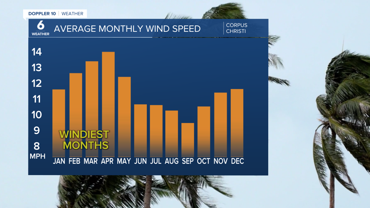
CORPUS CHRISTI, Tx — Have you noticed the winds haven’t been quite as “disrespectful” lately? For starters, let's talk about the climatology of our wind. The wind speeds for a typical month of August are around 10 mph.
Our windiest months are usually mid-late spring, with April being our windiest month on average. Our calmest month is generally in September. To understand the "why" behind these changes, we need to understand what wind is. NOAA defines wind as air in motion; it is the movement of air from one place to another.
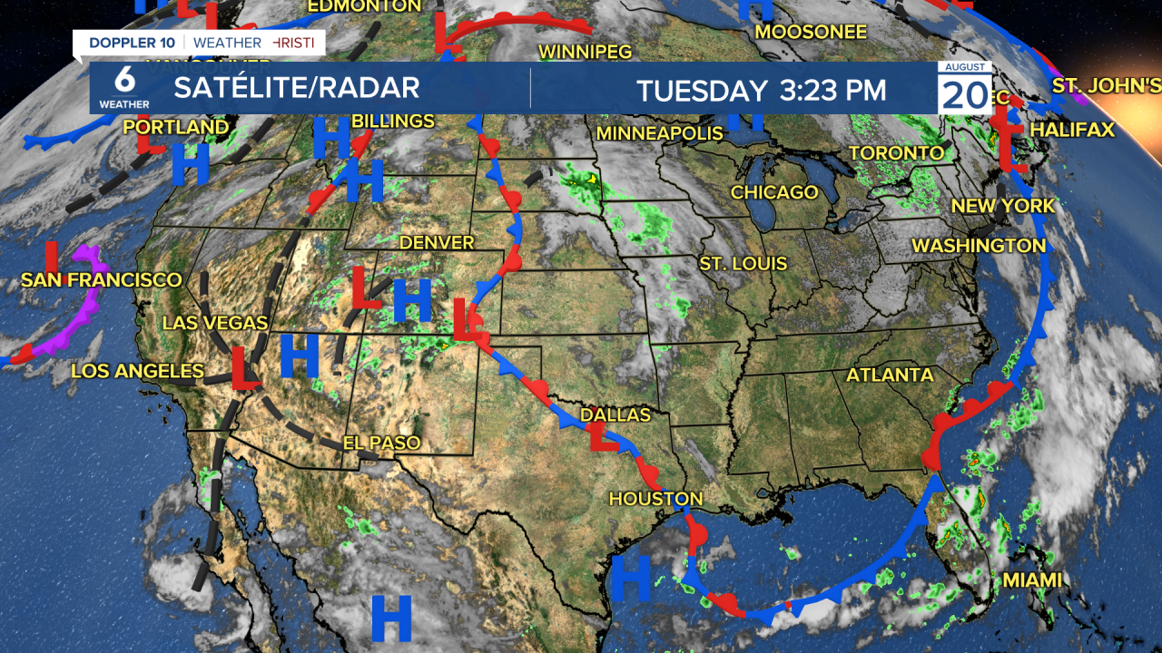
So what causes wind? The short answer: temperature differences around the world cause changes in air pressure. You've heard of high and low pressure, typically seen on a map as “H” for high pressure, and “L” for low pressure. When warm air rises you are left with low pressure; whereas, when cold air sinks, high pressure forms.
Like most things in nature, air of higher pressure moves toward area of lower pressure in an effort to find balance. The movement of this air becomes the wind that we experience.
Ever wonder why we go from light, subtle breezes to strong winds? Simply put, the change in pressure over a distance or "pressure gradient", determines our wind speed. When the pressure gradient is weaker, we experience less wind. When the pressure gradient is stronger, air will move faster from high to low pressure, so the wind is stronger.
Many factors can cause a change in pressure. One example is when a tropical system is nearby. Tropical depressions, storms, and hurricanes have a relatively deep center of low pressure in the core of the storm. As these systems near us, they interact with neighboring high pressure.
That's one of the reasons we experience very strong winds even when a storm doesn't come to the Coastal Bend. This is one example many of us know well!
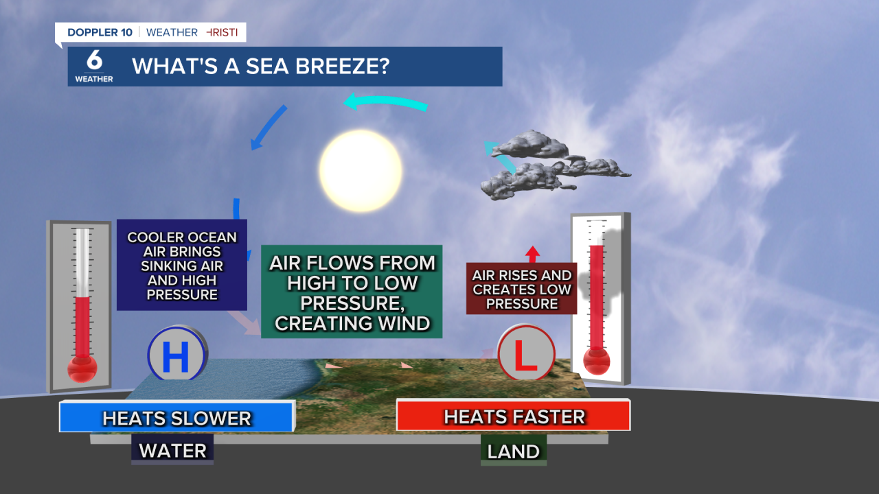
You may have heard of the sea breeze, but have you heard of the land breeze? Land and water heat and cool at different rates. As land heats up quicker than water during the day, hot air rises, creating lower pressure.
While pressure decreases over land, the relatively higher pressure over the ocean want to move in and even out the difference in pressure. This mkovement of air inland is known as the sea breeze. At night, the land cools off faster than the ocean; this now creates the opposite effect and air begins flowing from land back to the ocean (from higher to lower pressure).
So from these examples, you can see that temperature changes have a big impact on our wind. For that reason, our winds tend to be calmer during the morning and pick up in speed during the hottest part of the afternoon — all because of daytime heating.
In August, when we experience the hottest temperatures, the Lone Star state is usually under a broad area of high pressure. So with little change in pressure, comes very little wind!
