


CORPUS CHRISTI, Texas — Happy Weekend, Coastal Bend!
WHAT YOU NEED TO KNOW
- A Flood Watch, Small Craft Advisory in effect until Monday afternoon
- Coastal Flood Advisory and high rip current risk through Monday night
- Additional 2-4 inches of rain possible through Tuesday
Road Closures
- BENAVIDES: Flooding along Main St.
- FM 1717: closed from FM-3320 to FM-2619 high water over bridge. Travel is discouraged
- FM 2045: San Fernando Creek bridge closed to due to high water crossing the bridge. Travel is discouraged
School Closures
Because of heavy rain and flooding, several Coastal Bend schools are closed or delayed Monday.
Closed:
- Santa Gertrudis ISD
- Ben Bolt-Palito Blanco ISD
- Ricardo ISD
- Premont ISD
- Riviera ISD
- Tuloso-Midway High School (roof leaks)
Delayed:
- San Diego ISD: two-hour delay, school starts at 10 a.m.
- Bishop ISD: two-hour delay, according to Ricardo ISD
- Coastal Bend College: Beeville, Alice and Kingsville locations open at 10 a.m.
Click here to read Jada Strayer's full story.
County office and court delays
- Jim Wells County offices: Opening at 10:30 a.m. Monday because of the weather and unsafe travel conditions. County employees should report at that time unless their supervisor tells them otherwise.
- Jim Wells County Court at Law (misdemeanor court): The 9 a.m. docket was moved to 10:30 a.m. because of the weather and hazardous road conditions. Court has not been canceled, and all defendants must appear at 10:30 a.m.
Official Rainfall Totals (as of 6:00 PM CST Sunday)
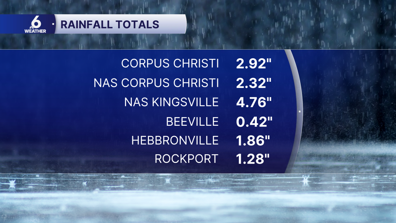
Other Observation Sites:
- ASOS/AWOS 7 SE Ben Bolt - 7.95 inch
- Mesonet 8 N Premont - 7.28 inch
- Mesonet 5 SW Benavides - 6.03 inch
- Mesonet 1 SE Kingsville - 5.13 inch
- ASOS/AWOS 3 E Kingsville - 4.63 inch
- Mesonet 1 N Kingsville - 4.33 inch
- Mesonet 3 NW Kingsville - 4.27 inch
- Mesonet 3 N Falfurrias - 4.24 inch
- Mesonet 6 W Riviera - 4.22 inch
- Mesonet 1 SW Kingsville - 3.94 inch
On Sunday, Corpus Christi broke its previous daily rainfall record for November 8th, which was 1.47 inches of rain set back in 1987! We ended up at 2.71 inches for the new daily record.
FORECAST
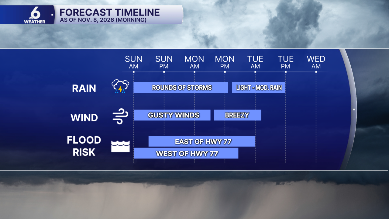
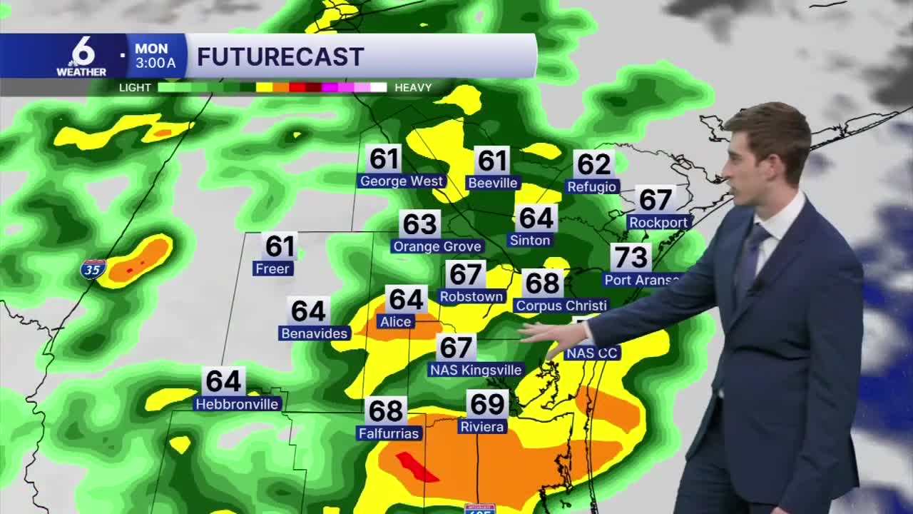
Rainfall resumes overnight
The first round of torrential downpours across South Texas has (mostly) come to an end. Heavy rain prompted numerous flash flood warnings across the Coastal Bend. We're expecting heavy rainfall to return overnight, impacting the Monday morning commute. With many neighborhoods receiving an abundance of rain on Sunday, additional heavy rain will pose another threat for flooding. Gusty winds and intense downpours are in the forecast through Monday afternoon. The rain will begin a downward trend starting late Monday. A few isolated storms remain will linger on Tuesday.
Flooding
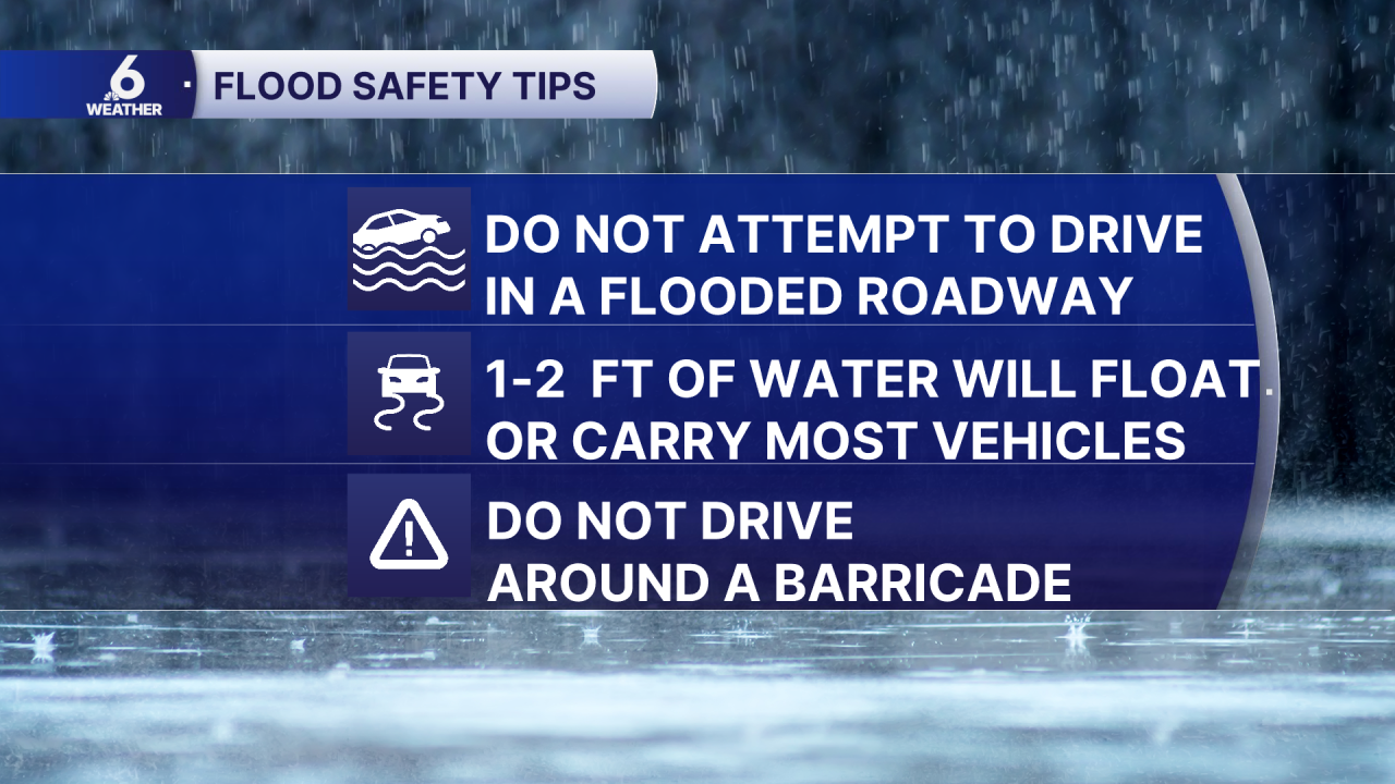
The Coastal Bend is under a level 2 out of 4 Slight Risk for excessive rainfall that could lead to flooding in the Coastal Bend for Sunday. Our neighborhoods can pick up between 2"-4" of rain, with localized higher totals possible as high as 7"-9". Storms that continue to develop over the same neighborhoods could pose the threat of flash flooding, which is why the flood watch is in place through Monday morning. While rainfall is very much appreciated here in South Texas, too much of it at once can be problematic.
Gusty Winds
Wind gusts may be "disrespectful" at times and approach 35 mph Monday afternoon. This could make driving difficult and break small tree limbs.
Hazardous Marine Conditions
These winds will generate choppy to rough waters from Baffin Bay up the Texas coastline on Monday. A Coastal Flood Advisory is in effect. Expect a high risk of rip currents, especially during high tide.The Small Craft Advisory will expire on Monday afternoon.